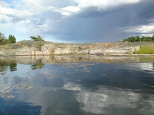
The aim of the project MMÖG is to produce appropriate GIS layers for the management of the marine area of the county of Östergötland. The GIS layers describe the physical as well as the biological conditions, including layers of classified potential natural values. The project also aims at establishing the quality of depth and bottom substrate layers that have been produced by different methods, and how these quality levels affect the biological results.

Brackish Water-crowfoot (Ranunculus peltatus ssp. Baudotii) in the archipelago of Östergötland. (Photo: Julia Carlström).
MMÖG is a joint project by AquaBiota, the County administration board of Östergötland, the Swdish geological survey (SGU) and Norrköping municipality. MMÖG is financed by the Swedish Environmental Protection Agency, who also participates in the reference group of the project in together with the administrative boards of a number of other counties. AquaBiota coordinates the project and models and produces maps of e.g. bathymetry, currents, salinity, presence of benthic biota and classes of expected natural values. The Swedish Maritime Administration delivers point data on depth, and the Swedish Geological Survey models bottom substrate. The County Administrative Board of Östergötland develops methods for classification of potential natural values of modelled biota in collaboration with the Municipality of Norrköping and AquaBiota. Data on presence of benthic biota have been compiled from previous studies by the County Administrative Board of Östergötland. Supplementary data have been collected through drop video surveys by AquaBiota and field the county administration board. The project runs 2009-2010.

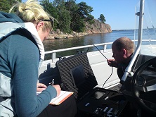
Surveying benthic biota using drop video. (Photo: Julia Carlström).
Report (in Swedish with English summary): Modellering av Östergötlands marina habitat och naturvärden.