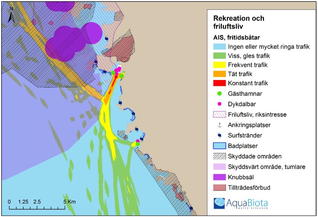
A comprehensive collection and analysis of GIS files provided support for the municipal work on marine spatial planning. Interests in the form of conservation values and different forms of utilization were analysed to identify potential conflicts and synergies. Moreover, the result will be used in the ongoing review of the national marine spatial planning.

On behalf of the municipality of Varberg, AquaBiota mapped and compiled existing marine planning documents with a spatial context. This included GIS maps of marine biology, national interests and various forms of utilization such as shipping, fishing, coastal exploitation, etc. During the compilation, knowledge gaps in existing data were examined and described. The compiled material was analysed with regard to present and future interests, their mutual relationships as well as potential conflicts.
The results were intended to provide support to the municipality for a dialogue on the national marine spatial plan, as well as basis for decisions for a future municipal marine plan as part of the municipality’s comprehensive planning.
Find the project report (in Swedish): Enhus, C., Tano, S. & Fyhr, F. 2017: Underlag för kommunal havsplanering i Varbergs kommun. AquaBiota Report 2017:04. 96 sid.

Many different sectors use the environment at Varberg’s coast and sea.